


LOS ANGELES - March 31, 2022 - (Newswire.com)
DroneBase, the leader in intelligent aerial imaging, is simplifying management of solar energy systems with its Serial ID app that quickly captures solar panel manufacturing and location data.
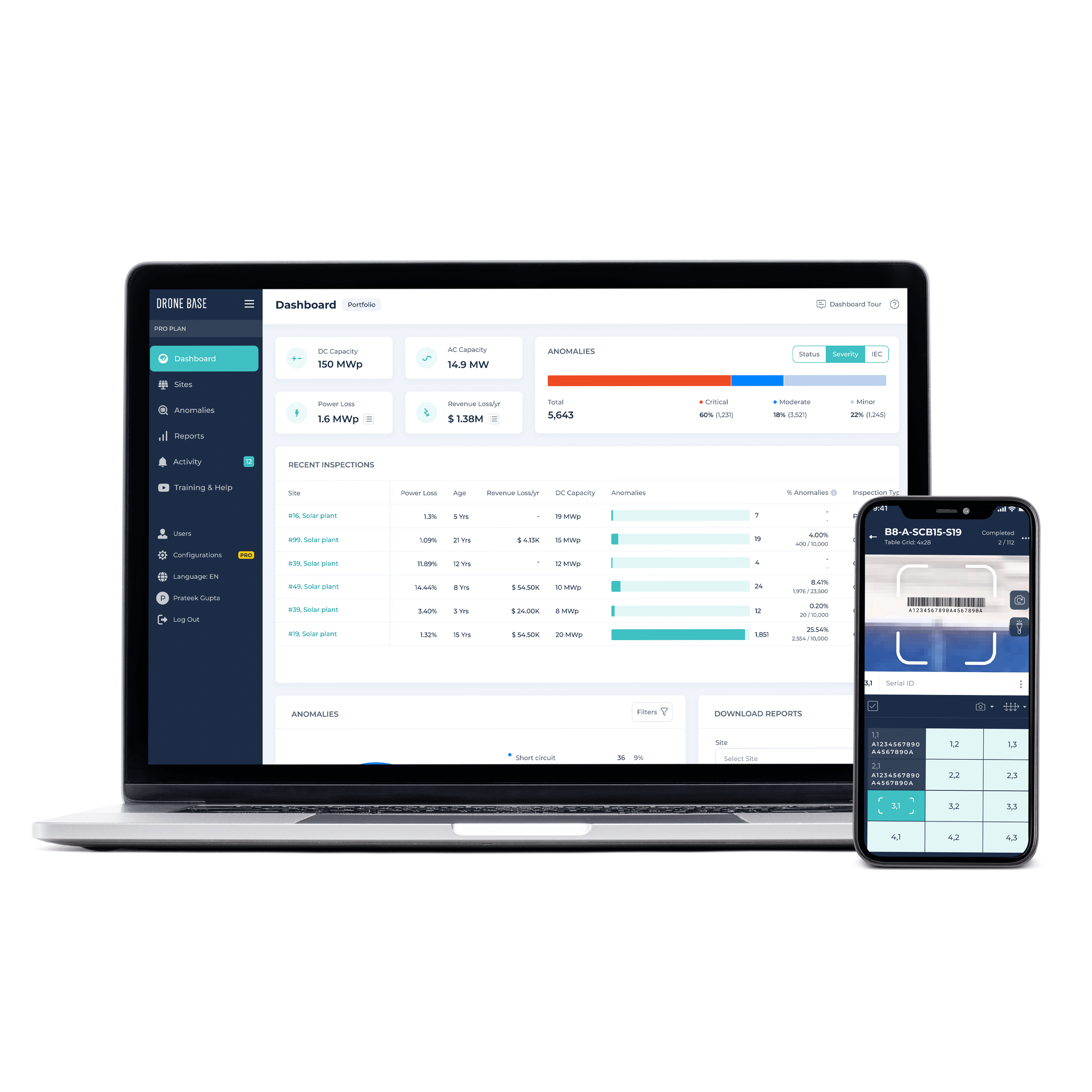
"Commercial solar energy systems are essentially a sea of glass — some comprising hundreds of thousands of panels. Finding specific panels for recalls or warranty claims is a costly challenge. I've seen asset managers remove the wrong panels and invalidate warranties or miss recalls. DroneBase has solved that problem with our Serial ID app," said Mark Culpepper, GM Global Solar Solutions for DroneBase. "A field technician with a smartphone and the DroneBase Serial ID app can efficiently scan the barcode on a panel during system development. Two seconds per panel saves hundreds of labor hours later and protects the value of a solar energy system."
The DroneBase easy-to-use app enables developers and asset owners to capture location and manufacturing data by scanning the barcode sticker on each panel. The data is tagged with geolocation, module coordinates, and inverter/string level information, making it quick and easy to search for OEM run/lot data and to find the exact panel location.
Culpepper continued, "Data is key to better solar energy system performance. Capturing panel information starting on day one of project development creates the proper record for recalls and for warranty and insurance claims."
The Serial ID app is available for download for DroneBase clients at both the Apple and Android stores.
DroneBase recently announced its North American Solar Scan (NASS) manned aircraft flights that scan solar energy systems throughout North America during spring and fall 2022. Easily determine whether a system is on the flight path with the NASS search bar located here.
To learn more about DroneBase and intelligent aerial imaging solutions, visit dronebase.com.
About DroneBase
DroneBase is the leading intelligent aerial imaging company for high-value infrastructure, providing businesses with actionable, real-time insights to recover revenue, reduce risk, and improve build quality. Headquartered in Santa Monica, California, DroneBase serves customers in the solar, wind, insurance, construction, real estate, and critical infrastructure industries. Trusted by the largest enterprises in the world, DroneBase is active in over 70 countries.
Contact
Loretta Prencipe
202.658.9024 | loretta.prencipe@dronebase.com
Press Release Service by Newswire.com
Original Source: DroneBase Serial ID App Makes It Simple to Scan and Geotag Solar Panel Data
